Property Record
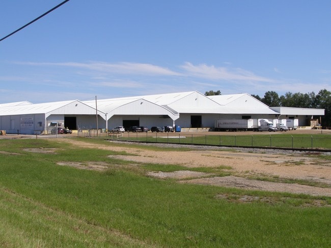
1350 Flowood Dr, Flowood, MS 39232

Property Detail
1350 Flowood Dr
E09I-000002-00000
29.471A E OF FLOWOOD DR & S OF UNDERWOOD DR IN SW4 SW4 & NW4 SW4 DB 467 PG 0363 0072084 DB 724 PG 0036 0021595
Warehouse
Rankin
B and X Area of moderate flood hazard, usually the area between the limits of the 100-year and 500-year floods.
Mississippi
2024
29.47 AC
2025
Brandon/Flowood/Pearl
020304
Jackson
207,912 SF
Jackson, MS
NEARBY LISTINGS FOR SALE OR LEASE
DEMOGRAPHICS near 1350 Flowood Dr
1 mile
3 mile
5 mile
2025 Total Population
371
24,673
82,373
2030 Population
382
24,390
81,632
Pop Growth 2025-2030
+ 2.96%
(1.15%)
(0.90%)
Average Age
39
38
39
2025 Total Households
148
10,989
34,488
HH Growth 2025-2030
+ 4.05%
(1.46%)
(1.02%)
Median Household Inc
$60,500
$46,201
$44,099
Avg Household Size
2.30
2.10
2.20
2025 Avg HH Vehicles
3.00
2.00
2.00
Median Home Value
$229,487
$188,308
$153,646
Median Year Built
2000
1970
1967
Nearby Places
Map Layers
Map Styles
 Street
 Aerial
Layers
 Traffic
 Biking
Places
Listings with unknown addresses are not visible on the map
- Restaurants
- Banks
- Shops
- Fitness
- Groceries
PUBLIC TRANSPORTATION
COMMUTER RAIL
Drive
Walk
Distance
12 min
6.1 mi
AIRPORT
Jackson-Medgar Wiley Evers International
Drive
Walk
Distance
Jackson-Medgar Wiley Evers International
19 min
8.4 mi
Nearby Properties
Address
Land Use
TOTAL SIZE
Lot Size
Zoning
Address
Land Use
TOTAL SIZE
Lot Size
Zoning
435,199 SF
1 AC
Address
Land Use
TOTAL SIZE
Lot Size
Zoning
74,923 SF
0.01 AC
Address
Land Use
TOTAL SIZE
Lot Size
Zoning
14,236 SF
7.38 AC
Address
Land Use
TOTAL SIZE
Lot Size
Zoning
9,650 SF
0.55 AC
Address
Land Use
TOTAL SIZE
Lot Size
Zoning
48,134 SF
6.62 AC
Address
Land Use
TOTAL SIZE
Lot Size
Zoning
Address
Land Use
TOTAL SIZE
Lot Size
Zoning
7.60 AC
Address
Land Use
TOTAL SIZE
Lot Size
Zoning
7,561 SF
153.82 AC
Address
Land Use
TOTAL SIZE
Lot Size
Zoning
Address
Land Use
TOTAL SIZE
Lot Size
Zoning
206,400 SF
7.96 AC
Address
Land Use
TOTAL SIZE
Lot Size
Zoning
117,983 SF
7.01 AC
Address
Land Use
TOTAL SIZE
Lot Size
Zoning
40,445 SF
3 AC
Address
Land Use
TOTAL SIZE
Lot Size
Zoning
51,260 SF
1 AC
Address
Land Use
TOTAL SIZE
Lot Size
Zoning
413,174 SF
2 AC
Address
Land Use
TOTAL SIZE
Lot Size
Zoning
236.80 AC
Address
Land Use
TOTAL SIZE
Lot Size
Zoning
96,444 SF
0.88 AC
Address
Land Use
TOTAL SIZE
Lot Size
Zoning
247,574 SF
0.94 AC
Address
Land Use
TOTAL SIZE
Lot Size
Zoning
115,200 SF
0.35 AC
Address
Land Use
TOTAL SIZE
Lot Size
Zoning
17,261 SF
18.20 AC
Address
Land Use
TOTAL SIZE
Lot Size
Zoning
46,958 SF
0.77 AC
Address
Land Use
TOTAL SIZE
Lot Size
Zoning
32,886 SF
1 AC
Address
Land Use
TOTAL SIZE
Lot Size
Zoning
59,840 SF
2.72 AC
Address
Land Use
TOTAL SIZE
Lot Size
Zoning
31,541 SF
4 AC
Address
Land Use
TOTAL SIZE
Lot Size
Zoning
30,925 SF
38.73 AC
Address
Land Use
TOTAL SIZE
Lot Size
Zoning
2,190,610 SF
2 AC
Address
Land Use
TOTAL SIZE
Lot Size
Zoning
47,885 SF
0.01 AC
Address
Land Use
TOTAL SIZE
Lot Size
Zoning
69,034 SF
0.64 AC
Address
Land Use
TOTAL SIZE
Lot Size
Zoning
40,148 SF
37.47 AC
Address
Land Use
TOTAL SIZE
Lot Size
Zoning
64,949 SF
3 AC
The World's #1 Commercial Real Estate Marketplace
Connect with us
© 2026 CoStar Group
The information above has been obtained from sources believed reliable. While we do not doubt its accuracy we have not verified it and make no guarantee, warranty or representation about it. It is your responsibility to independently confirm its accuracy and completeness. Any projections, opinions, assumptions, or estimates used are for example only and do not represent the current or future performance of the property. The value of this transaction to you depends on tax and other factors which should be evaluated by your tax, financial, and legal advisors. You and your advisors should conduct a careful, independent investigation of the property to determine to your satisfaction the suitability of the property for your needs.